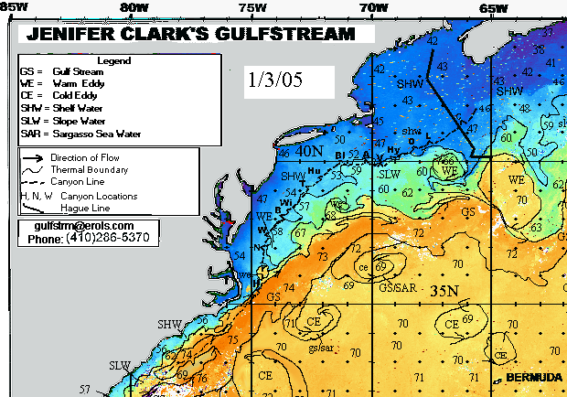
North Gulf Stream Chart
The sample North Panel Gulf Stream chart above depicts:
Sea surface temperatures are in degrees Fahrenheit. The 100 fathom line and Hague Line (boundary between U.S. and Canadian water) are also included.
Click on the images below to view samples of other available charts:
South Panel of the Gulfstream
Entire Gulfstream
Gulf of Mexico
(All charts displayed on these pages are out of date and for example only. Realtime charts are produced three times a week and must be ordered.)